Reality Capture
.°
Redefined
From survey-grade LiDAR payloads to handheld 3D scanning, GeoCue delivers reality capture solutions built for accuracy, efficiency, and adaptability. UVT integrates these tools with the training, support, and expertise your team needs to turn complex sites into actionable digital assets.
Why with ?
Instead of just selling hardware, our team is laser focused on delivering complete workflows that connect the field to the office, ensuring your scans become reliable, usable intelligence. GeoCue’s TrueView sensors and LP360 software provide survey-grade data capture and streamlined point cloud processing, while UVT equips your team with end-to-end integration, onboarding, and Always On support.
More DetailsGeoCue TrueView 1
The GeoCue TrueView 1 balances affordability and performance, delivering precision LiDAR data for demanding projects. Configurable with 26MP, 45MP, or 61MP global-shutter cameras, it adapts to your resolution needs while keeping workflows efficient. Supported by LP360 Drone, it enables survey-grade point cloud processing, DEM/DTM generation, and accurate as-built documentation. From DOT corridor mapping to infrastructure inspections, the TrueView 1 gives organizations a reliable way to create high-quality digital twins and geospatial assets. Integrated and supported by UVT, the TrueView 1 is more than a payload—it’s a complete solution for teams moving from capture to decision-making with confidence.


GeoCue TrueView 1 Lite
The GeoCue TrueView 1 Lite is the entry point into survey-grade drone LiDAR, designed for teams adopting 3D reality capture for the first time. Lightweight and efficient, it provides dependable data for topographic mapping, terrain modeling, and construction verification. By pairing with LP360 Drone software, the TrueView 1 Lite streamlines point cloud classification and georeferencing, making complex datasets easier to manage and deliver. Ideal for AEC and environmental projects, it offers an affordable path to building digital assets and digital twins. With UVT’s Always On training and support, your team gains confidence in turning flights into actionable intelligence. confidence.
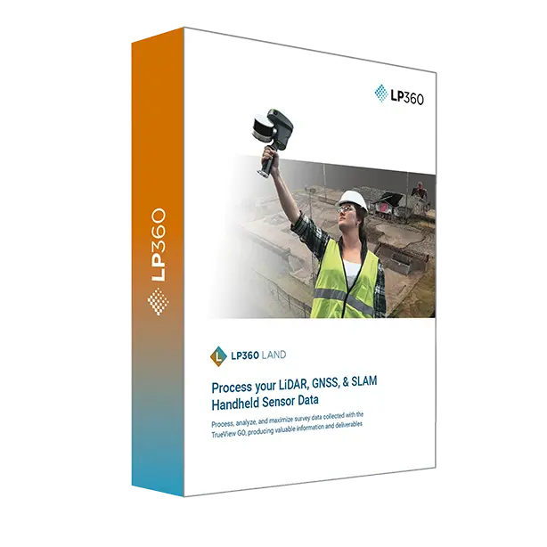
GeoCue TrueView GO 116S & 132S (Handheld)
The GeoCue TrueView GO handheld series empowers Public Safety teams with flexible 3D reality capture for crime scene documentation, crash reconstruction, and forensic mapping. Combining SLAM-based mobile LiDAR with GNSS RTK, it enables accurate, survey-grade point clouds indoors, outdoors, and even underground. Lightweight and portable, the TrueView GO simplifies scanning in complex environments where UAVs can’t operate, creating near-to-scale diagrams and dense point cloud data in real time. With UVT’s training and Always On support, agencies gain a trusted tool for evidence preservation, digital twins, and mission-critical documentation.


GeoCue TrueView 515 / 535 / 540
The GeoCue TrueView 500-series is engineered for advanced airborne LiDAR mapping at scale. With long-range laser scanning and high-density point cloud capture, these payloads excel in corridor studies, volumetric analysis, and complex terrain modeling. Surveyors and engineers use the 515, 535, and 540 for mining, utilities, DOT infrastructure, and environmental monitoring where accuracy and consistency are non-negotiable. Paired with LP360, they streamline classification, feature extraction, and deliverables across CAD, GIS, and digital twin platforms. Backed by UVT’s Always On expertise, the TrueView 500-series transforms large-area data collection into an efficient, repeatable, and fully supported geospatial workflow.


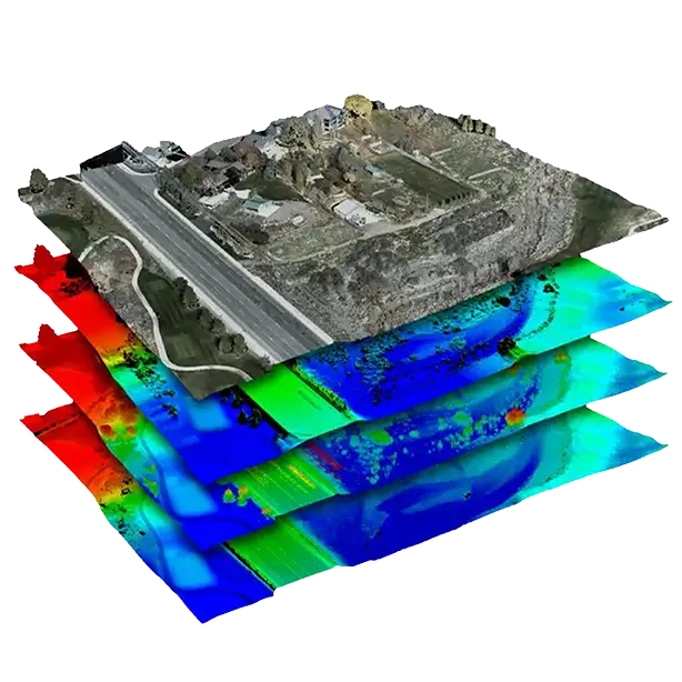
From Capture to Intelligence
Reality capture is only the beginning. With LP360, GeoCue’s point cloud processing platform, your scans become actionable data. Generate classified point clouds, extract features, and produce deliverables in standard formats (LAS/LAZ, E57) ready for ArcGIS, AutoCAD Civil 3D, QGIS, and more.
Real-World Ready
Backed by UVT.
UVT doesn’t just sell drones—we build custom-tailored programs shaped by your mission’s unique needs. When you deploy an GeoCue solutions through UVT, you gain a partner with the expertise to design, integrate, and support a fully operational system. Our team helps companies and enterprise organizations implement GeoCue hardware and software to keep you Always On.

Always On Support
U.S.-based experts, ready when you need us
Field-Tested Workflows
Proven in construction, public safety, utilities, and beyond
Training & Enablement
Onboarding designed to make your team confident in the field and efficient in the office
End-to-End Integration
Hardware, software, and service connected into one operational solution
We're here when you need us
Our Solutions Specialists are standing by to provide you with price quotes, on-site demo scheduling, and answers to your GeoCue questions
We use our experience as program managers and First Responders to help agencies like yours hone in on the perfect solution for your mission.
Industry Expertise. We take an experience-driven approach when it comes to guiding our customers toward the right solutions.
Zero Pressure. Our entire sales process is ZERO pressure from start to finish and tailored toward enterprise purchasing to make sure you get the equipment you need, when you need it.
Diverse Product Catalog. We've spent almost an entire decade cultivating a diverse product catalog with solutions that solve real-world problems.
Unwavering Dedication. When we say nobody can support you the way UVT does, we mean it.